|
|
Your Add
Could be Displayed
HERE Contact
the
|
|
Your Add Could be Displayed HERE Contact
the Webmaster
|
|
Chicken Corners ATV Trail
This is one of my favorite trails. This is
an easy trail and most people should be fine on it. It offers
some beautiful views of Kane Creek canyon and the Colorado River.
It will take about 4 hours.
This trail starts at the parking lot on Kane Creek Road. On
main street in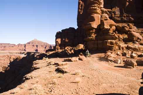 Moab you will turn west at the McDonalds
on Kane Creek road.
Continue west until there is a Y intersection. Stay left and
continue up pass the Moab Rim trail. A trailhead parking lot
is where the road turns from blacktop to dirt. Plenty of
trailer parking on the ride side of the road. There is also
several parking area's up the dirt road. There is posted BLM
fee camping area's up Kane Creek Canyon. There is one camp
ground before the dirt road and many on the dirt road. If you are pulling a
trailer beware that there is a steep/sharp S-Curve down the dirt
road Moab you will turn west at the McDonalds
on Kane Creek road.
Continue west until there is a Y intersection. Stay left and
continue up pass the Moab Rim trail. A trailhead parking lot
is where the road turns from blacktop to dirt. Plenty of
trailer parking on the ride side of the road. There is also
several parking area's up the dirt road. There is posted BLM
fee camping area's up Kane Creek Canyon. There is one camp
ground before the dirt road and many on the dirt road. If you are pulling a
trailer beware that there is a steep/sharp S-Curve down the dirt
road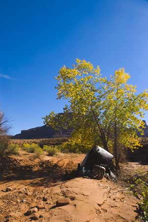 before the camping places. Also there is the river you
will have to go through at least once. When I was there, there had been
some good rain storms and some of the camping spots were washed out. before the camping places. Also there is the river you
will have to go through at least once. When I was there, there had been
some good rain storms and some of the camping spots were washed out.
The road to Chicken Corners is mostly graded and
anyone should be able to ride it. From the parking lot you
will follow Kane Creek Road going through the river two times.
There will be a fork in the road where there is a metal sign left up
Kane Creek canyon and straight - right up to Hurrah Pass. The
trail goes up over Hurrah pass and then over towards the Colorado
River. At the pass there is a
Potash Plant across the Colorado river where they die the water blue in the
evaporation ponds. There is two other forks after Hurrah pass.
The first fork is streight to Chicken Corners and right to to
Jackson Hole, not in Wyoming. The next fork goes to Lockhart Basin
left (very difficult trail), Chicken Corners right. The trail ends at the Colorado
River across from Dead Horse Point State Park shown below.
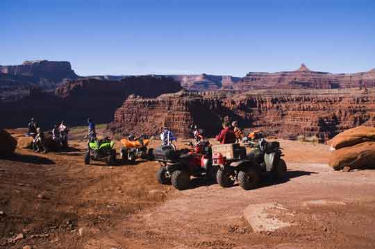
There is a very
skinny hiking trail along the cliff that goes around a corner from
the parking area which is where this trail gets it name. Are
you to chicken to walk around the corner. If you decide to
hike around the corner be very careful I don't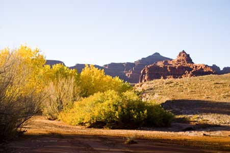 know if anyone has
died there but if you fell you would. I would recommend you
take pictures from the parking lot of the Colorado River, there is
nothing around the corner and the view is the same. If you
look close you can see the visitors center at Dead Horse Point.
This is a one way road so you will have to return the same way you
came. Watch for Rocky Mountain Sheep in the
area. know if anyone has
died there but if you fell you would. I would recommend you
take pictures from the parking lot of the Colorado River, there is
nothing around the corner and the view is the same. If you
look close you can see the visitors center at Dead Horse Point.
This is a one way road so you will have to return the same way you
came. Watch for Rocky Mountain Sheep in the
area. |
|
Tell us your favorite place to go riding (Your Favorite
Trail not listed suggest a destination)
|

|
|
Your Add
Could be Displayed
HERE Contact
the
My Camera
|
|
|
|
UtahATVTrails.info is hosted by HostGator
©Copyright 2020 Askew Specialty Group L.L.C.
All rights reserved |